Assessing the Ozark Plateau (continued) |
||||||
Topography/Landforms and Geology The Ozark Plateau consists of rolling land with many steep slopes and hillsides covered in deciduous hardwood forest. The area contains
the oldest surface rocks in the state, limestones that formed
during the late Mississippian Period, about 345 million years ago. These rocks indicate that the land was above and below the sea during the Mississippian and when the sea advanced, these limestones
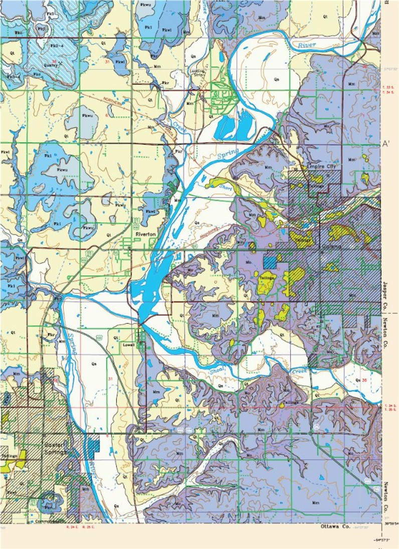
and some shales were deposited. After the sea's retreat, erosion began. As detailed in the image below, the border of the Ozark Plateau closely follows Spring River on the West and North and the state lines of Missouri and Oklahoma. |
||||||
Legend for Ozark Plateau Area of image Qa = Alluvium Qt=Terrace deposits and deep soils Mm = Meramacean (Warsaw limestone) Mo= Osagean (Burlington-Keokuk limestone, a cherty limestone) |
||||||
The only area of Mississippian age limestone of significant size past the river is in the Baxter Springs area (considered part of the plateau) and to the north of the area where the river has a distinctive curve and toward the top of the above cropped image. Water flows through joints and fractures of the soft Mississippian limestones, creating caves and nuturing seeps and natural springs. These natural karst features drain into streams that flow over cherty gravel-beds in steep-bluffed valleys and produce the distinctive topographic relief unique to the southeastern corner of Kansas. One such bluff runs west of Spring River and is visible from the highway that extends from Baxter Springs into Oklahoma. Schermerhorn Park at Galena, KS, has many examples of these unique features of the Kansas Ozark Plateau. |
||||||
Mississippian Limestone
to Right of Schermerhorn Cave Main Entrance,
Galena, KS
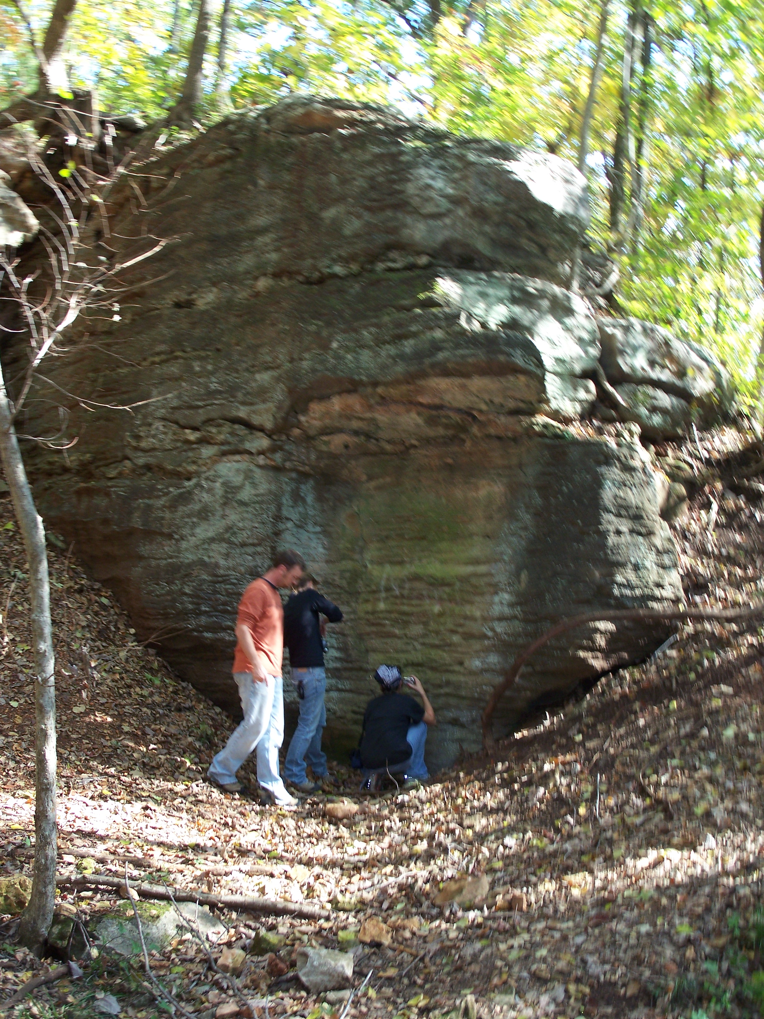 Image acquired with Kodak C875 Digital Camera, Image © G. Manders |
||||||
The highest point in the Ozark Plateau has an approximate elevation of 317 meters (1,040 ft.) and is just a few kilometers east of one of the lowest points, in the Spring River Valley and with an approximate elevation of 234.7 meters (770 ft.). According to Jim McCauley, KS Geological Survey, the lowest point is close to the location where Kansas and Oklahoma state lines meet. He also noted some of the best outcrops of Mississippian age rock are to the southwest of the waterfall south of Shoal Creek. The area is difficult to reach due to fencing. Another area of interest is the Gaineswood subdivision to the southeast of Baxter Springs due to the pronounced hills in the area. To Top of Page The lead and zinc deposits formerly mined in the Tri-State Mining District occur in these Mississippian rocks. Regional dip of these formations is to the west and northwest at approximately thirty feet
per mile. The Ozark Plateau has greater topographic
relief and streambeds steeper with rock and gravel than the bordering physiographic region, the Cherokee Lowlands. Along the Spring River and the area’s streams is rich alluvium and in smaller areas beyond the alluvium, terrace deposits and deep soils. Spring River is recognized as the western
border of the Ozark Plateau. To the west of the river the Mississippian rocks are no longer outcropping but rather underlie rocks of Pennsylvanian age and west of the river the landscape quickly
changes to prairie. |
||||||
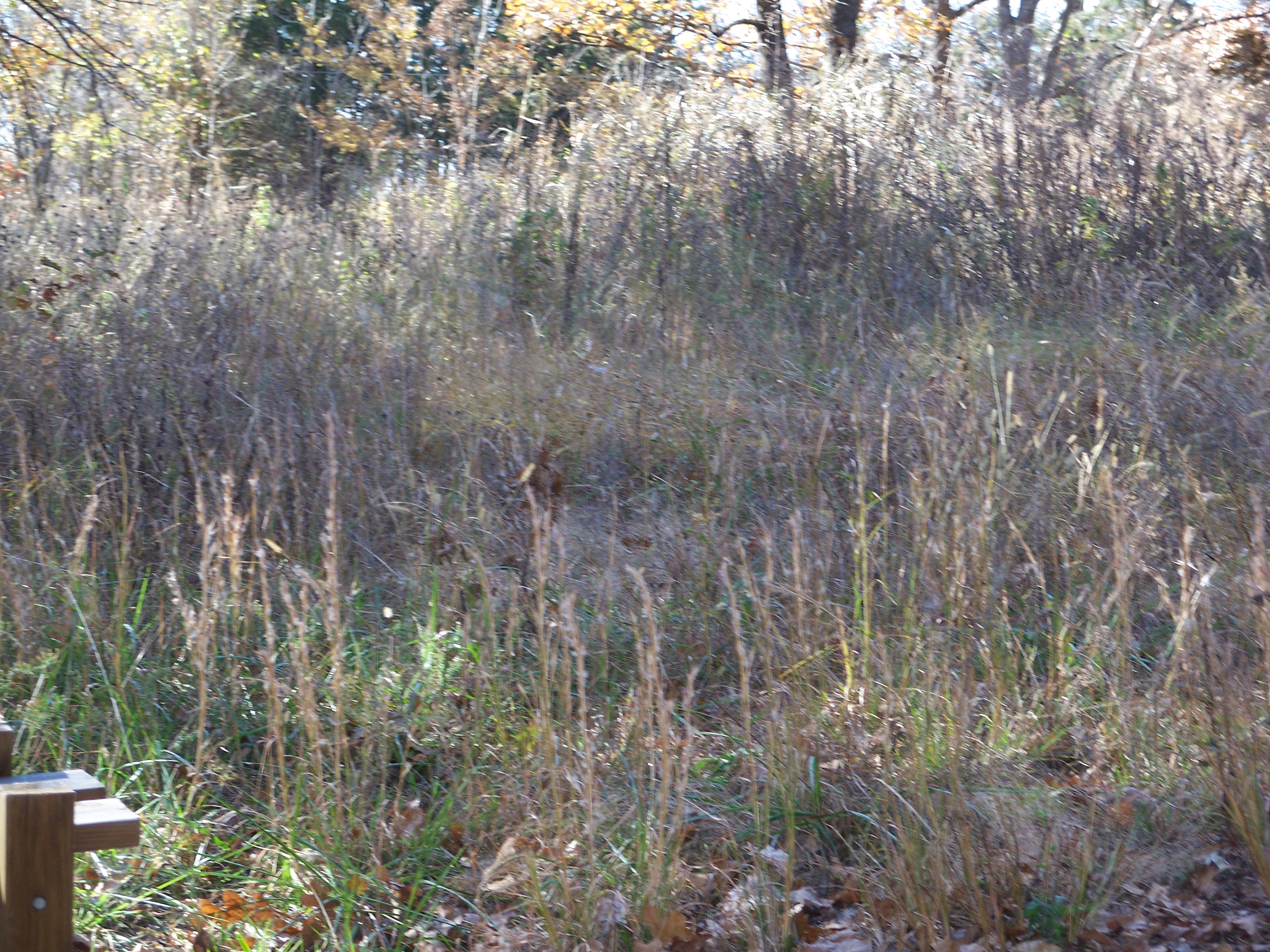
Vegetation The Ozark Plateau is in the Eastern Tallgrass Prairie Conservation Region of the state of Kansas. The Ozark portion is a mixture of prairie, woodlands and forests. Tallgrass prairie and some sandstone and limestone glades have been found on uplands. Some areas contain native rangeland grass species such as big bluestem, little bluestem, Indian grass and porcupine grass. Forests include oaks, hickories, other trees and shrubs covering most of the hillsides. Pecan, Shumard oak, pin oak, white sassafras, and river birch grow along rivers and streams. Flowering dogwood thrives on uplands and some uplands include large manmade clearings. Most prairie has been cleared. Low-lying lands surrounding Spring River support many different species of plants. At Schermerhorn Park, hardwood forest graces steep hills, riparian vegetation borders areas of Shoal Creek and an open savanna surprises those that find it tucked beyond a winding path. |
||||||
|
||||||
Soil is suitable for crops in the Spring River and Shoal Creek valleys. Some of the vegetation, such as sassafras trees and mistletoe, is not found anywhere else in the state. To Top of Page |
||||||
| Home | Next-Assessing the Ozark Plateau (continued) |
|||||