 Image Source: Kansas Geological Survey |
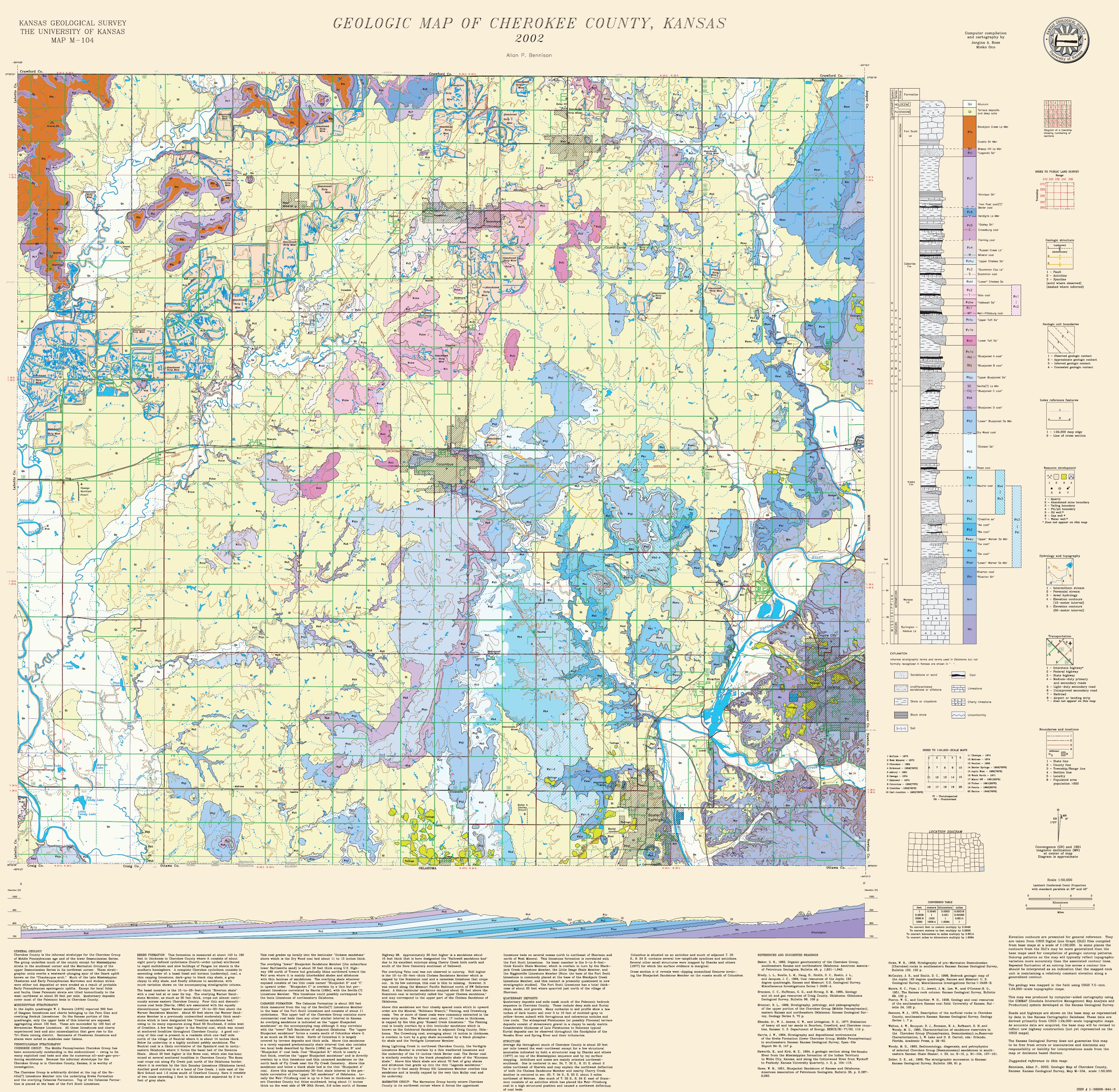
| Image Source: Bennison, Allan P., 2002, Geologic Map of Cherokee County, Kansas: Kansas Geological Survey, Map M-104, original scale 1:50,000, ISBN# 1-55806-944-3. |
| Return to Assessment of Ozark Plateau |