Cherokee County Superfund Site-A Work in Progress |
||
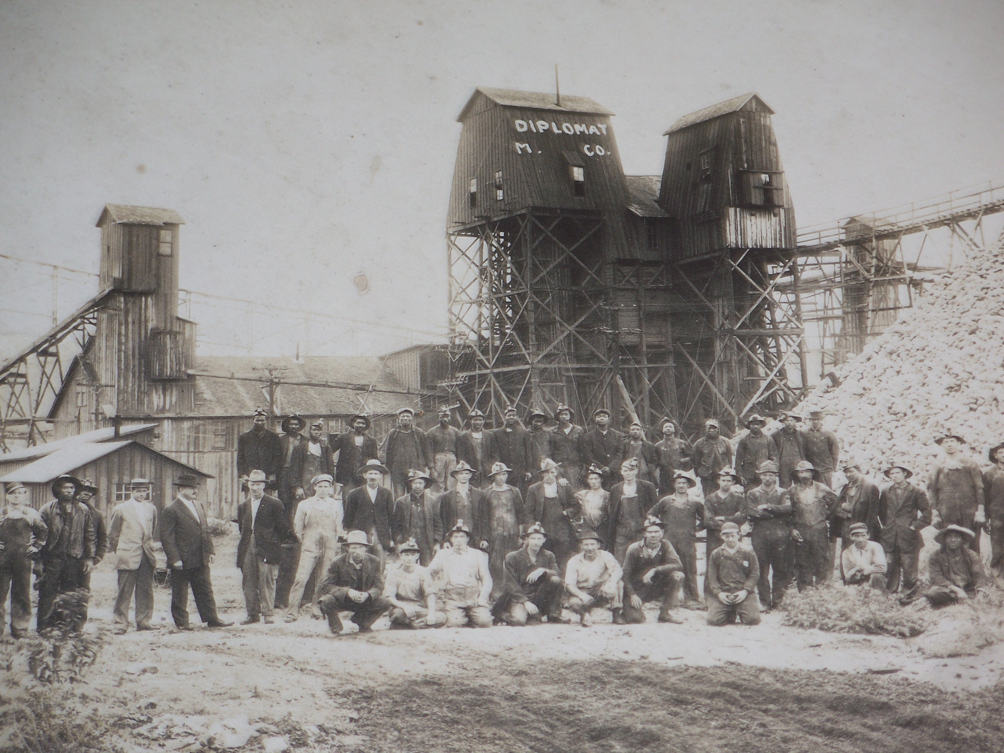
The lead and zinc ores in the Tri-State Mining District occur in cherty limestones of Mississippian age. The formation of these ores is believed to be linked to hydrothermal solutions that move vertically from deep in the earth, to the porous and permeable limestones. An overlying blanket of shale forced the hot solutions to move laterally and as a result, the spreading solutions deposited sphalerite (zinc sulfide), galena (lead sulfide), and other associated minerals including dolomite, calcite, jasperoid, chalcopyrite and marcasite. The mining district also produced by-products, germanium and cadmium. Cadmium is usually present in sphalerite in small amounts and was a by-product of zinc smelting (Brosius and Sawin, 2001). Early mining involved many small operators on small acreages with each operator conducting mining, drilling and milling. This resulted in many shafts, wast piles and mine structures scattered throughout the Picher Mining Field and the Kansas Ozark Plateau. The Galena area contains the oldest mining of the subsites with mining dating back to the
1870s.
The character of the mining and mine hazards in Galena is
unique. Because the ore occurred at the surface in the Galena area, the ore was mined from the surface down. This allowed small operations to grow and from the beginning the Galena mining site became known as "poor man's camp." To learn more about the problems with the mines click here. To Top of Page |
||
Former Location of Wall Separating Mining Communities of Galena and Empire City 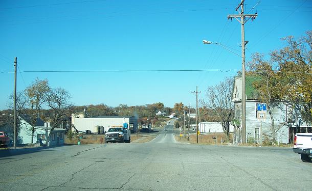 Image acquired with Kodak C875 Digital Camera, Image © G. Manders |
||
The community of Galena now includes what was formerly known as Empire City. The two mining communities of Galena and Empire City did not get along and had a wall between the two. The area where the wall once stood now has railroad tracks. |
||
Cherokee County Superfund Site Subdivisions 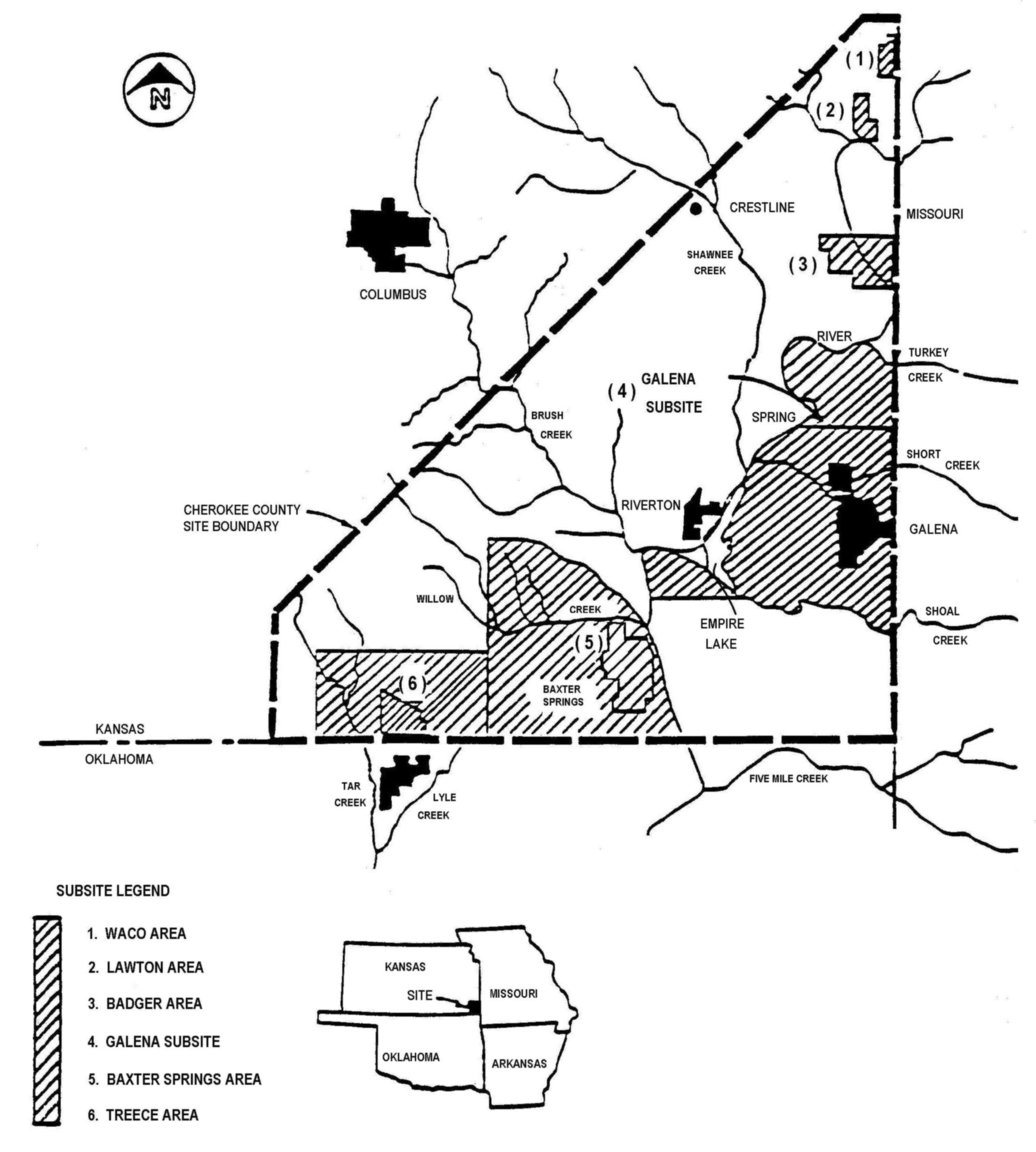 Image source: Emily Wheeler, Kansas EPA mailed file on CD |
||
The Galena area subsite of the Cherokee County Superfund site is within the Ozark Plateau region of Kansas. Although the community of Baxter Springs is within the plateau area, much of the Baxter Springs area subsite is not within plateau boundaries. It falls within the Picher Mining Field which extends into Oklahoma. The Baxter Springs subsite is underlain by underground workings with mine depths ranging from 200 to 500 feet. It has been more than 30 years since the lead and zinc mining ended in the Tri-State Mining District of southeast Kansas yet residents and visitors continue to see the effects of this industry on the land, underground and sadly, in our area's water. Commercial mining in the Kansas portion of the Tri-State District began in the mid-1870s and continued until 1970. During this period, total production in Kansas was estimated at 650 thousand tons of lead and 2.9 million tons of zinc. This long history of lead and zinc mining left a degraded environment for southeast Cherokee County, Kansas, and a legacy for future generations. To Top of Page Residential soils in Galena were affected not only by mining and mining wastes but also by smelter wastes from a former operating smelter close to town that was deposited by wind. Remediation of the Galena subsite site began in the early 1990s by sealing shaft openings, filling open pits and surface collapses, and revegetating with native grasses. The soil was replaced at over 700 properties in residential areas. Remediation efforts also included the removal and regrading of some chat and rock piles throughout the superfund site. |
||
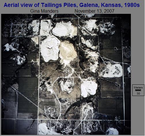 Image Source: Dave Drake, EPA Region 7 via email, processed with Idrisi Andes© and Microsoft Picture It© Photo software |
||
Emily Wheeler, EPA Region 7, noted the Ozark Plateau area mines that have been filled in were filled by dumping dry chat and boulders that are approximately 1-2 feet across. The large rocks selected for filling are generally not mineralized and so were left by the miners as waste rock. Dave Drake, EPA Region 7, reports there has been a lot of progress in addressing the problem of chat tailings piles. He stressed most of Galena’s have been bulldozed, covered in topsoil and remeditated & approximately half in Baxter Springs have been remediated as well. Hell's Half-Acre, an area just east of Galena was bulldozed and covered in 2006. The following process is being used to address the challenge of mine waste. Mine wastes are re-graded and consolidated followed by capping and some wastes are placed back into the collapse features which are also capped and re-vegetated when full. More recent cleanups involve much more consolidation to reduce the footprint of the wastes than traditional historic actions. Additionally, the more recent work involves more robust capping, that is 1.5 feet and placing the wastes into collapse features versus 0.5 feet and amending with compost, mulch, and hay. Dan Imming, Galena, KS resident, noted sinkholes continue to form suddenly in the community. Recently, one opened up in a city park and curious residents stood at the side and peered down into the hole. Mr. Imming noted he could see mining equipment below the ground in the hole. He also noted although the cave-ins and sinkholes in Galena are difficult to predict he complimented the EPA on their quick response upon being notified of a developing sinkhole. |
||
Before Remediation, Baxter Springs, KS, Area
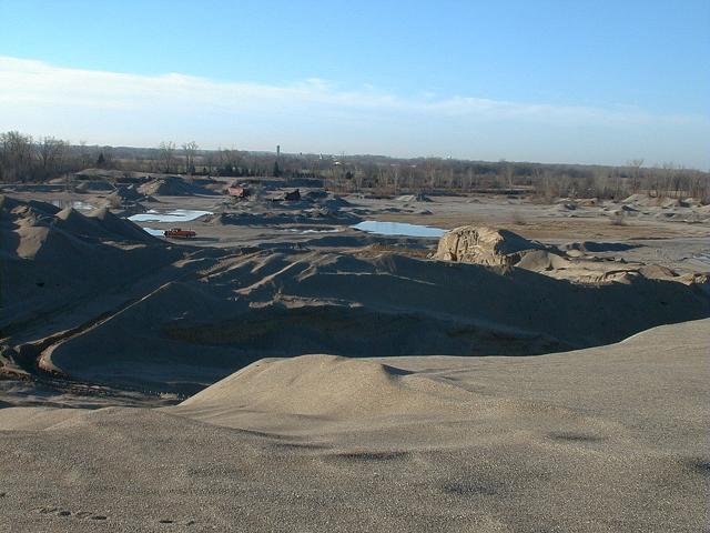 Image Source: Dave Drake, EPA Region 7 via email |
After Remediation, Baxter Springs, KS, Area 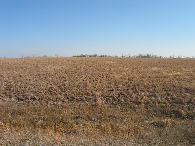 Image Source: Dave Drake, EPA Region 7 via email |
|
In Baxter Springs driving in the direction of Oklahoma from McDonalds Restaurant a chatpile still looms in the distance. Tailings impoundments in the area are still mostly bare, not covered by vegetation. Some mined areas now have some cattails growing in the area. The collapsed mine near Baxter Springs’ gas lines has been filled in so that danger has reportedly been neutralized. Discharge of mine water and runoff from chat piles and out of tailings ponds has contaminated receiving streams and streambed sediment and affected the health of sediment-dwelling life such as the Neosho madtom (Noturus placidus), a small catfish on the Federal endangered species list. Extensive studies of effects on children have indicated a significant drop in lead and other levels. Past mining activity has contaminated the sediment in Empire Lake with cadmium, lead, and zinc concentrations much greater than background concentrations and much greater than probable effects levels for toxic biological effects. Cadmium, lead, and zinc concentrations in the bottom sediment of Empire Lake have gradually decreased over time after the end of lead and zinc mining in the area. Yet, concentrations in recently deposited bottom sediment exceeds the probable-effects guideline by 440-640% for cadmium, 40-80% for lead, and 580-970% for zinc. Probable-effects guidelines are 4.98 parts per million (ppm) for cadmium, 128 ppm for lead, and 459 ppm for zinc. Researchers are concerned about the risk of the lake's bottom sediment becoming resuspended during high inflow and the lake could become a source of contaminated sediment. Not only have Empire Lake, Spring River Basin and at least five of the creeks in the plateau been adversely affected by mining activities but also the discharges from flooded underground mines and runoff from tailings piles have poured large amounts of calcium, sulfate, dissolved solids, and zinc into receiving streams. To understand the scope of this problem consider that the contaminated sediment will move downstream, possibly as far away as Grand Lake of the Cherokees in Oklahoma. To Top of Page |
||
| Home | Next-Results and Conclusions |
|