Assessing the Ozark Plateau (continued) |
||
A Little About Two Communities of the Ozark Plateau
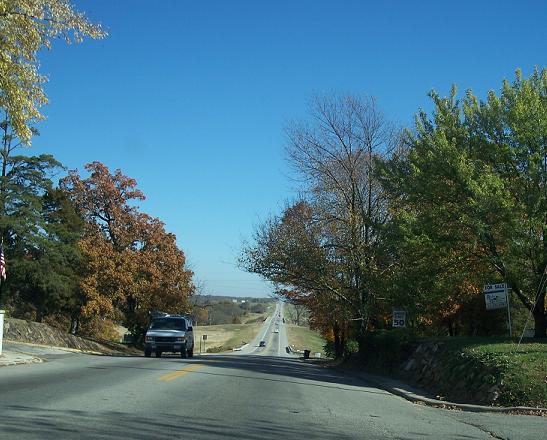
Baxter Springs and Galena lie within the Springfield Plateau section of the Ozark Plateau province. The location of Baxter Springs is approximately 37.023N latitude and -94.735W longitude and estimated elevation is 256.94 meters or 843 feet. The eastside of Baxter Springs is built on rolling land and is on the currently identified western edge of the Ozark Plateau. Baxter is surrounded by mining-impacted land. |
||
Leaving Baxter Springs to Drive to Galena The location of Galena is approximately 37.075N and - 94.639W longitude and estimated elevation is 274.93 meters or 902 feet. Mines are underlying Galena and the community has quite a task ahead due to subsidence and frequent sinkholes in town. Rather than requesting governmental buyout the community recently applied for and received a $250,000 grant from the US Department of Commerce’s Economic Development Administration to address the subsidence and cave-in problem in the city. The city will provide an equal amount through labor in its drilling project, for a total of $500,000 for the program. |
||
Galena, A City Trying To Dig Out of A Dilemma
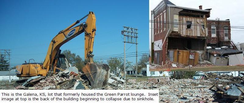 Left Image acquired with Kodak C875 Digital Camera, Image © G. Manders; Right Image Source: Dave Drake, EPA Region 7 |
||
The Galena mine stabilization will involve the drilling of about 300 holes downtown over approximately 18 months. Each hole will be drilled to a depth of at least 60 feet, and some will be drilled as deep as 100 feet. When a cavern is confimed with the drill, measurements will be taken to determine its size and each cavern will be mapped. The plan is to encase and cap each hole after drilling. After mapping of mines, plans call for filling the mine voids with a slurry of fly ash and water that would harden upon drying. The project could conceivably take decades as a prior estimate concluded that it could take a minimum of 20 years and possibly $64 million to fill the voids created by former mining beneath the community. To Top of Page |
||
Other Notable Features of the Ozark Plateau |
||
Cherokee County Superfund Site Click here for information regarding the Cherokee County Superfund Site--a factor that has, and will continue to contribute to the condition of the Ozark Plateau in southeastern Kansas. |
||
| Home | Next-Results after Reading About the Superfund Site |
|