Emporia State University
Fall 2011
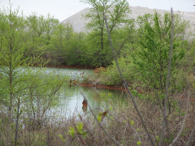
Image of chat pile behind mine collapse basin and forming wetlands near 40 Rd in Douthat area. Image by author, 2007.
This webpage was prepared by Gina Manders to fulfill an assignment for ES775 Advanced Image Processing
Emporia State University
Fall 2011
Image of chat pile behind mine collapse basin and forming wetlands near 40 Rd in Douthat area. Image by author, 2007.
Land cover in northern Ottawa County, northeastern Oklahoma has been ever-changing since the early 1900s due first to the effects of mining and more recently due to remediation efforts which are ongoing. This area, known as the Tar Creek Superfund Site, includes the old Picher Field lead and zinc mining area of northeastern Ottawa County. The site was placed on the EPA National Priorities List in 1983 and covers an area of approximately 40 square miles (~100 km2
Next
Home
Problems with this webpage? Please click here to notify author. Thank you.
© Gina Manders, 2011